Subjects
Grades
A catchment area (or watershed) is a portion of land from which all precipitation is collected and carried to a single point.
In order to facilitate the management and conservation of hydrological resources, hydrologists have divided the territory into several sections known as catchment areas. These represent areas surrounding different river systems.
The boundary of a catchment area is defined by natural boundaries. Under the action of gravity, water flows from the highest point to the lowest (from upstream to downstream). The boundary between two catchment areas is therefore located on a line that follows the crest of the surrounding mountains and hills. These boundaries are known as the watershed divide or drainage divide, or the ridgeline. When there is precipitation, it will fall on one side or the other of this divide: it will then flow into different catchment areas. Catchment areas include both surface and groundwater flows.
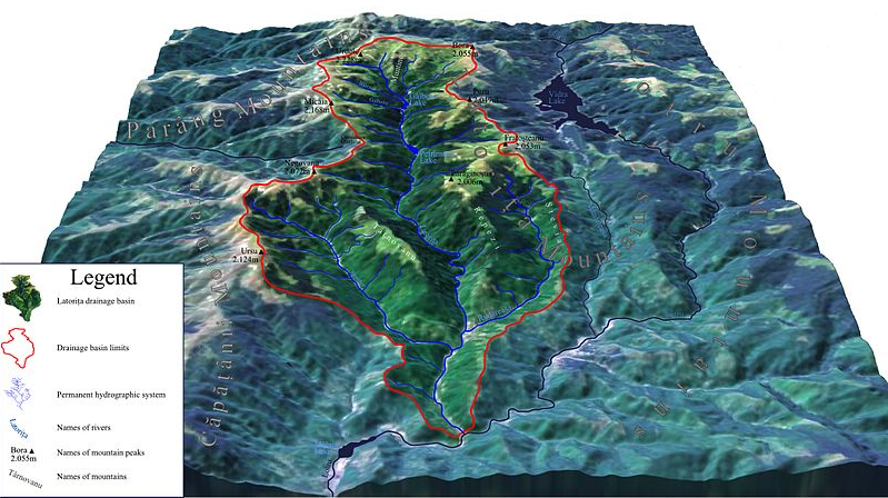
Representation of the mountain ridges that determine the natural boundary of a catchment area (the red line represents the watershed divide).
A number of factors can influence the way water flows within a catchment area.
Catchment areas can be seen as a network of interlocking watercourses. There are different levels of catchment depending on the scale being studied:
All other levels are sub-basins of the oceanic catchment.
In North America, there are 5 main ocean drainage basins. They are represented in the image below. They are the Pacific Ocean watershed (in yellow), the Gulf of Mexico watershed (in orange), the Atlantic Ocean watershed (in blue), the Hudson Bay watershed and the Arctic Ocean watershed (grouped together in the red section).
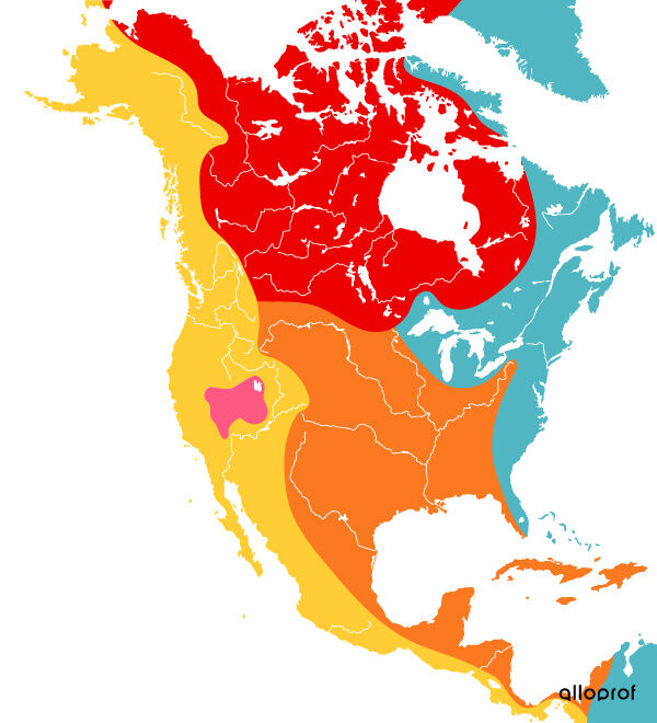
The distribution of catchment areas in North America
As for the basin represented by the colour pink, this is a catchment area known as the ‘Great Basin’, which groups together a number of watercourses in a desert region of the United States.
Moments in the video :
Certain human activities can have a significant impact on catchment areas. For example, clear-cutting (or excessive deforestation) can cause surface water to flow more quickly. This accelerated flow can increase soil erosion, leading to flooding and landslides.
In addition, pollution of the hydrosphere, through the release of toxic products into the water or through the leaching of residues produced by industries and mines, can contaminate the water source near the industry in question. However, according to the watershed principle, this water will flow into other catchment areas, contaminating several bodies of water. The impact on people living near these watercourses can therefore be very harmful.
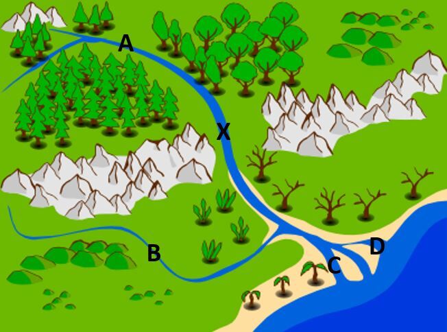
In the image above, water contamination has occurred at point X. It is therefore possible to determine which locations will be affected by this contamination by looking at the water flow map.